Silver Strike Project Overview
LOCATION Tombstone Mining District Cochise County, Arizona
METALS Silver-Gold-Copper-Lead-Zinc
STAGE Exploration
OWNERSHIP 100% Tarku
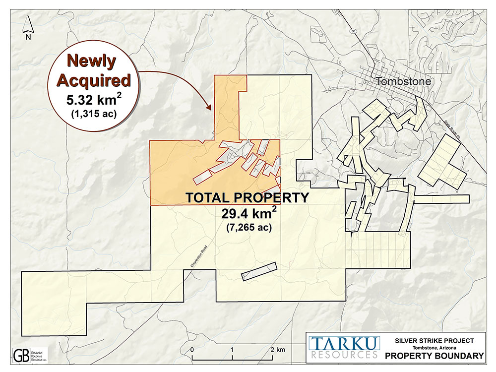
LAND POSITION 1,250 hectares
EXPLORATION HIGHLIGHTS
Latest News on the Project
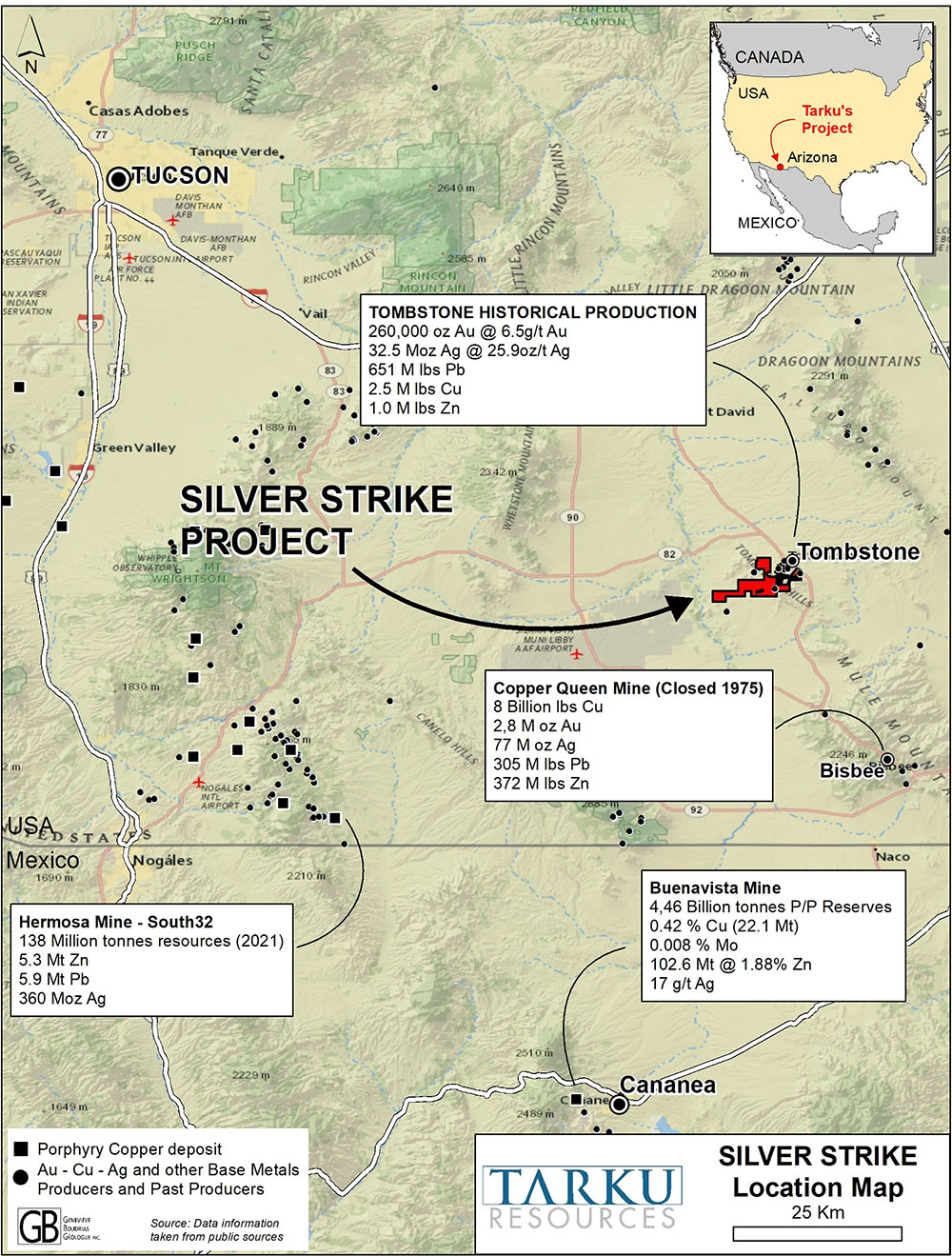
- Tarku’s Silver Strike Project is located in Cochise County, Arizona, in the famous Tombstone Mining District, one of the earliest silver mining areas in the western United States.
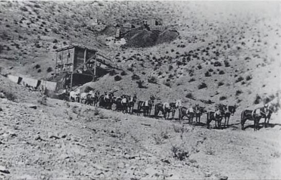
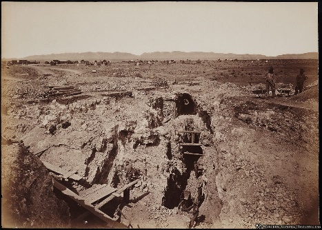
- Silver mining commenced in 1877 and around 32 million ounces of silver were produced, more than any other mining district in Arizona.
- Despite the attractive quantity of silver found in the district, the low metal prices of the 1915’s (below 1 USD/oz), financial panic, and the removal of the the silver standard (since the 1900s), technical inability to deal with underground waters, and bandits put an end to silver mining in the Tombstone region.
- The Tombstone District continued to be largely overlooked until recently. Tarku recognised that this historic mining camp has never been explored using modern exploration techniques and a thorough understanding of the regional geology and mineralizing systems.
Silver Mineralization Remains in Historic Workings
- More than 95% of the historic production in the area, is from the surface to a depth of 200 meters, with no real exploration below this level. Water ingress and lack of pumping ability, not a lack of mineralization, stopped the historic mining at this level.
- The majority of ore extracted was also oxide, with sulphide bearing silver ore largely remaining unmined. The area is also well endowed in gold and base metals.
- In addition to this near mine exploration potential is the possibility for new discoveries, using geochemical sampling, geophysics, and other techniques not available to the historic miners/prospectors.
New Areas of Silver Mineralization Discovered
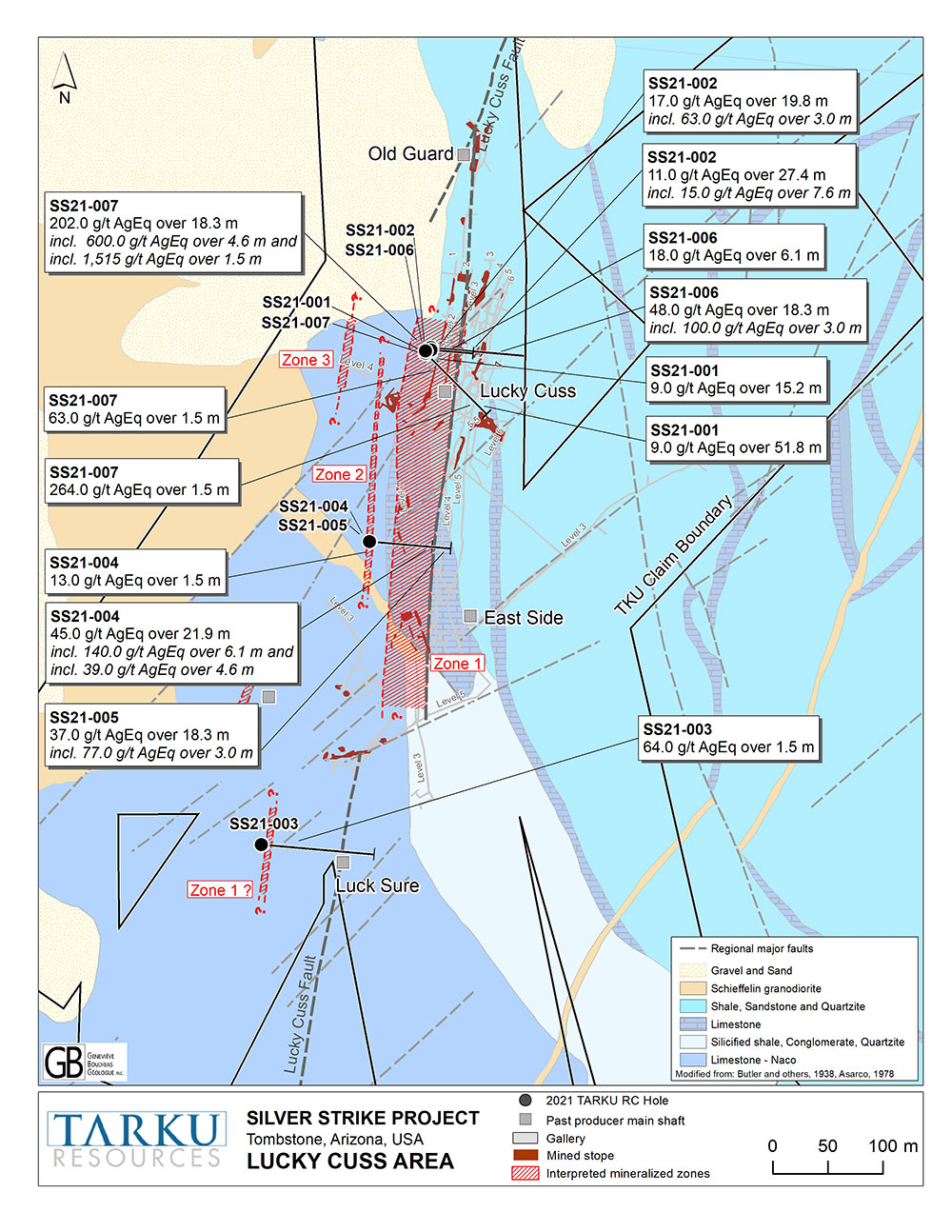
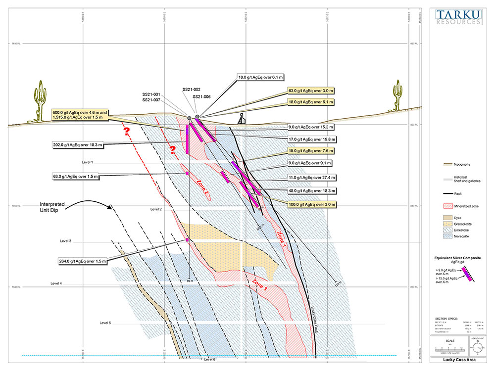
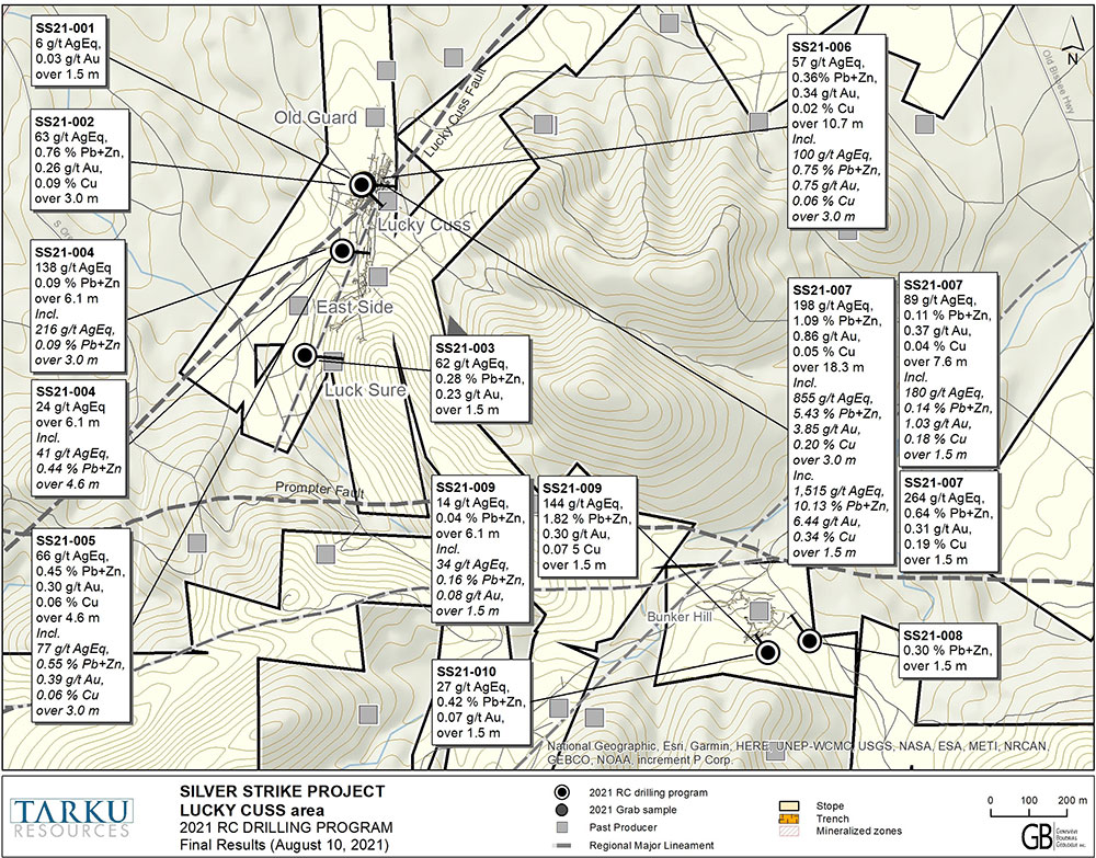
- The 2021 drill program at Silver Strike demonstrated the presence of new areas of mineralization with standout results from the Lucky Cuss Trend, with grades up to 1,515 g/t silver equivalent (AgEq) over 1.5 m (SS21-007).
- During 2022, Tarku is planning a high-definition geophysical survey over the Silver Strike Project, to refine targets ahead of a 5,000—meter drill program.
CRD Targets
- Based on an updated understanding of the geology Tarku now consider the primary targets to be carbonate replacement deposits (CRD), similar to the Hermosa Project, located 65km to the southwest, which was purchased in 2018 by South32 for US$1.8 billion.
- South32 recently completed a PFS at the Project, which suggests that at the current zinc price of US$3,600t, Hermosa could generate annual revenue of over US$1 billion.
- Hermosa currently has a resource estimate of 138Mt zinc-lead-silver sulphide and an Exploration Target ranging from 10Mt to 95Mt. Since acquiring Hermosa, South32 has increase its tenure in the are by 66% as it believes the region has significant potential for future discoveries of polymetallic and copper mineralisation.
Project History
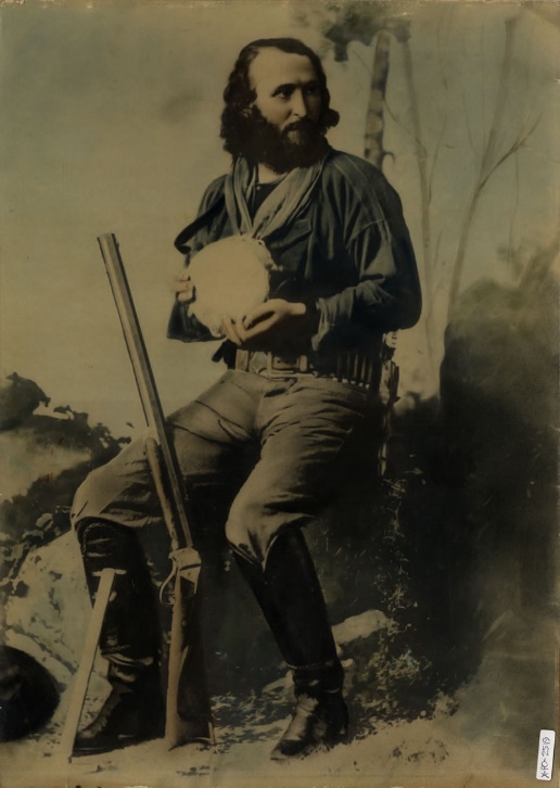
- 1877, Ed Schieffelin discovers a silver bearing vein
- 1878, prospectors rush to the area and the population grows from 100 to around 14,000 in under seven years
- June 17, 1879, Schieffelin showed up in Tucson, driving a wagon carrying the first load of silver bullion from the area valued at $18,744 (about $520,615 today)
- 1881, 6,000 miners were working on numerous silver mines in the district and the famous “gunfight at the OK Corral” happens between members of the “Cowboy” gang, and the three Earp brothers and Doc Holliday
- Late 1880’s, rising water in the mines caused many of them to close, by 1900 the population declines to 700
- Late 1950’s exploration revealed presence of lead and zinc
- 1965, limited drilling identifies copper mineralization
- Between 1980 to 1985, Tombstone Exploration Inc. operated an open pit mine on the Contention structure and produced up to 3,000 tons per day of ore averaging in the range of 1.25 oz/t Ag and 0.6 g/t Au. No exploration drilling conducted.
- 1989-1994, limited exploration completed by several companies focused on the Contention Open Pit area
- 2015, Arizona Mining discovered CRD zinc-lead-silver mineralisation located 65 km southwest of Tombstone at the Hermosa Project
- 2018, Arizona Mining acquired by South32 Limited for US$1.8-billion.
- 2020, Tarku Resources commences the first systematic exploration program on its license area
- 2022, South32 completes pre-feasibility study (PFS) for Hermosa, which demonstrated the potential for an operation to produce 280,000t of zinc equivalent per annum for 22 years.
The mineralisation in the Tombstone District is related to a large regional structure that trends northeast-southwest, known as the Lucky Cuss Fault. Mineralisation in the Tombstone area is believed to have been formed in the Late Cretaceous, and is associated with the district-scale Laramide Caldera.
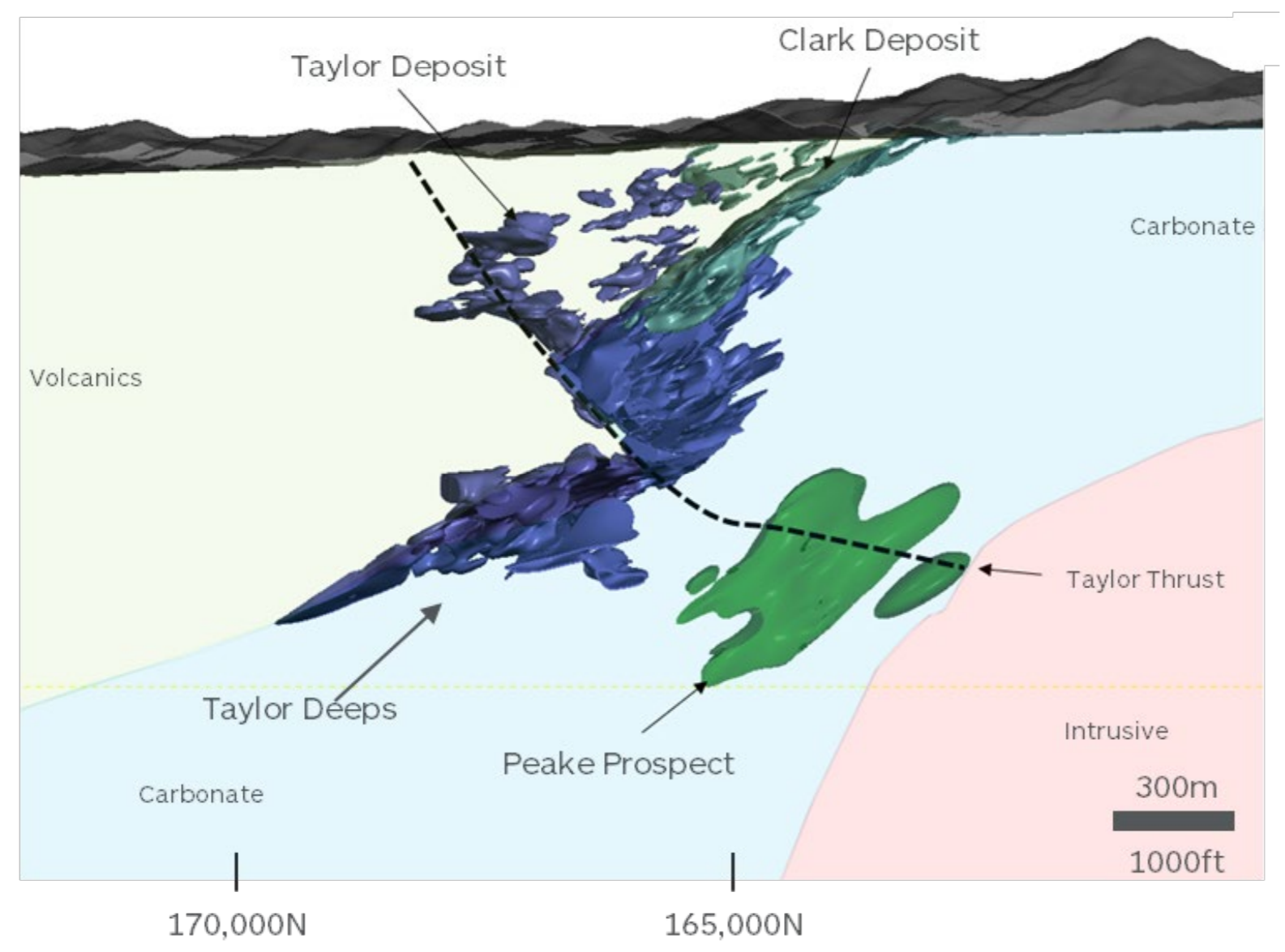
The carbonate replacement deposits (CRD) in the area are largely associated with limestones and limey siltstones of the Bisbee Group. The Bisbee Group is interpreted to be present in the Tombstone area at relatively shallow depths (<400 metres) based on surface mapping.
Elsewhere in Arizona Bisbee Group host significant mines, such as those at:
- Bisbee (2.8 Moz Au, 102 Moz Ag and 7.8 billion lbs Cu);
- Christmas (0.36 billion lbs Cu);
- Magma (0.7 Moz Au, 34.5Moz Ag and 2.5 billion lbs Cu) and;
- Hermosa (360Moz Ag, 5.3mt Zn and 5.9mt Pb);
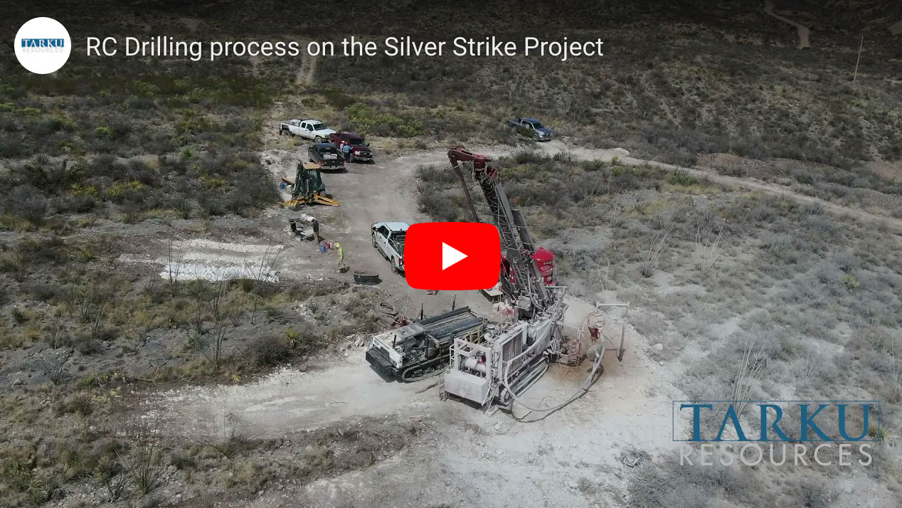
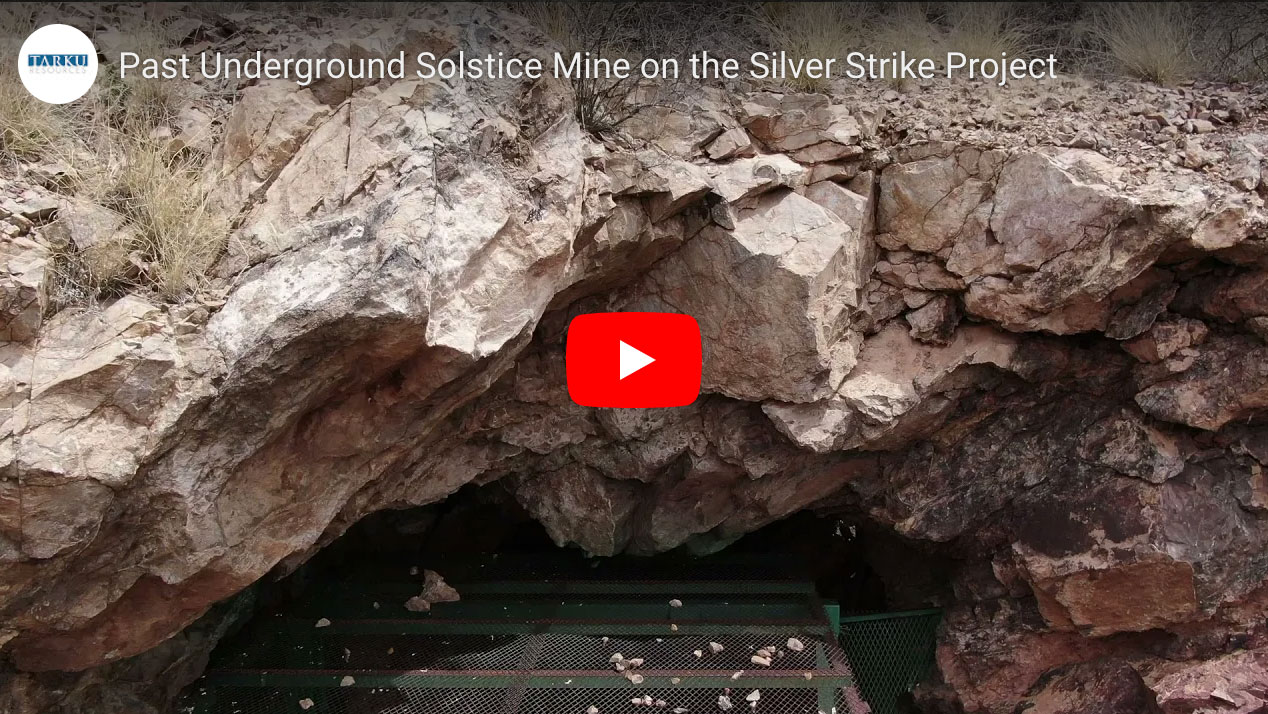
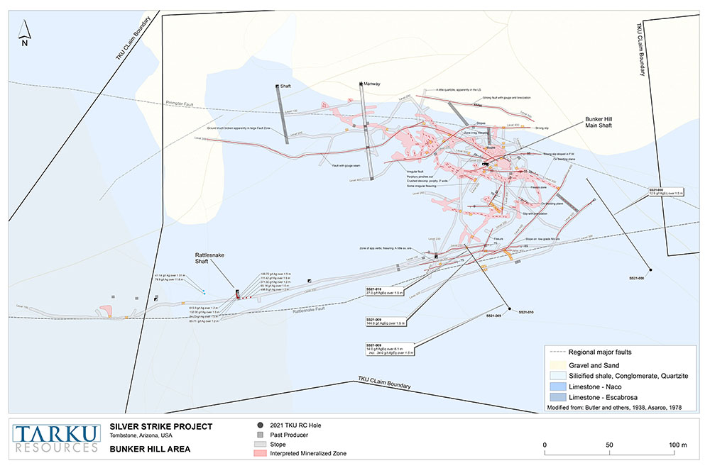
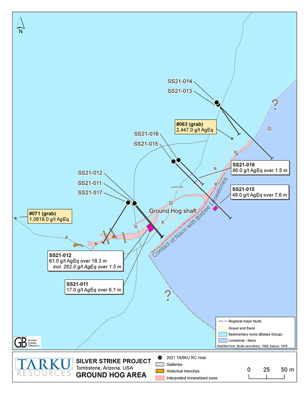
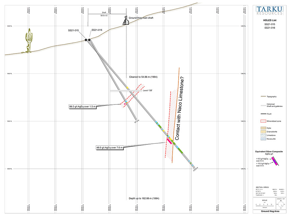
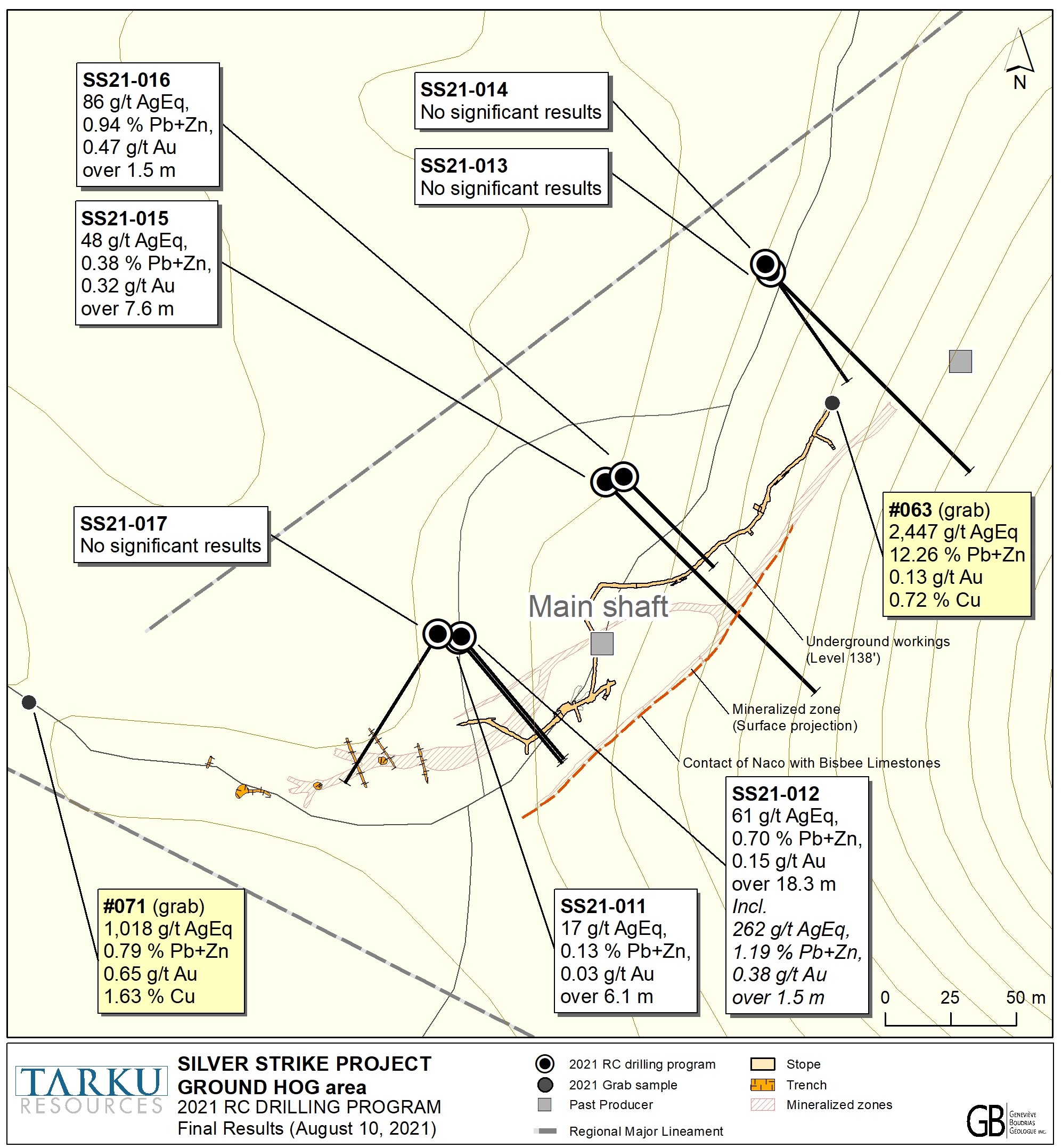
Tarku’s first drill program on the Silver Strike project was completed on May 28, 2021. The program of 23 RC drill holes totalling 8,921 feet (2,719.1 meters) was designed to test more advanced and early-stage targets that included the Lucky Cuss, Luck Sure, Telephone, Bunker Hill and Ground Hog historic mines, which produced high-grade silver to a maximum depth of 200 meters.
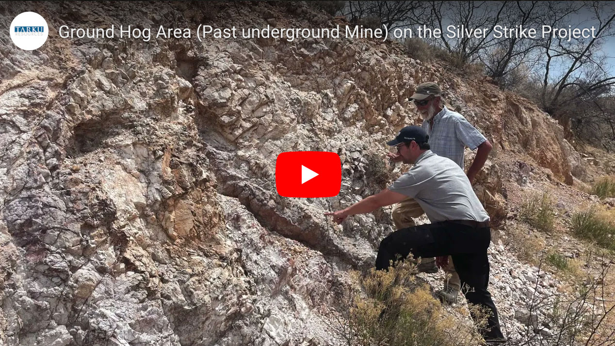
This program succeeded in defining high-grade mineralisation results close to historic mines and demonstrated the strong regional potential with high-grade silver surface sampling results at Ground Hog, 4km along strike from the historic mines.
- Tarku plans to undertake a deep penetrating and high-resolution geophysical survey over the priority targets defined in 2021;
- with a 5,000-meter drill program to follow.
The 5,000-meter drilling program will focus on surface to 400 meters depth along the Lucky Cuss and the Ground Hog trend.
Exploration drilling will also testing the best geophysical anomalies of the planned survey over the property.
Project History
Tombstone Mining district was one of the earliest silver mining areas in western United States that start producing numerous silver mines in 1877. Despite the attractive quantity of silver found in the district, the low metal prices of the 1915’s (below 1 USD/oz), financial panic, and the removal of the United States currency from the silver standard (since the 1900s), technical inability to deal with underground waters, and bandits caused this area to be overlooked.
Limited sporadic production in the area was recorded at different periods stimulated by a higher gold price. During World War II, studies were done for manganese deposits in the district in relation to the war effort. Exploration work in late 1950 revealed presence of lead and zinc. in 1965, limited drilling was completed probing for porphyry-copper-type model recovering alteration zones in the vicinity of breccia pipes and extensive but low-grade mineralization.
Between 1980 to 1985, rising silver price made Tombstone Exploration Inc. operate in a geological lower grade environment an open pit mine on the Contention structure and produced up to 3,000 tons per day of ore averaging in the range of 1.25 oz/t Ag and 0.6 g/t Au. No exploration drilling was ever conducted, and no ore reserves of significance were measured ahead of mining.
Geological Context
The area is characterized by mountain building episodes and sedimentation (mountain erosion) intruded by numerous granites. Locally most of the sediments are related to the Bisbee formation. Older rocks are unconformably overlying the Tombstones hills by tick sequences of sediments which are excellent host mineralization as they chemical and resistant characteristics make them break easily under tectonics stress and provide pathways for veins and mineralization. The principal production from the Tombstone mining district has been from high grade veins associated with those fractures.
Although Tombstone has primarily been a silver camp, substantial gold and lead, and subordinate copper, zinc, and manganese have also been produced. The silver to gold ratio for documented production between 1877 and 1937 is 126 to 1 and production has come mainly from mineralized vein fractures cutting folded sediments. Ninety-five percent or more of the production is from the surface to 200 m and is primarily from oxide ore minerals.
More recent publications and data compilation concluded that the volcanic geology and structure in the Tombstone area is related to a district-scale Laramide caldera. Mineralization in the district is also related to the caldera and attendant hydrothermal fluid migration. These districts are typically zoned from silver-rich peripheries to higher base-metal and gold contents near to the intrusions. Copper-gold mineralization occurs in intrusion-hosted stockworks or skans.
In the early 70’s, the American Smelting & Refining Company (ASARCO) obtained a lease on the Horne claims around the Robbers' Roost breccia pipe. They drilled three holes to a maximum depth of 1700m (5,000 ft) on a porphyry copper alteration zone in the vicinity of the breccia pipes. These holes intersected extensive but low-grade mineralization, grading vertically downward from a lead-zinc phase of mineralization into porphyry copper type mineralization, including disseminated pyrite, chalcopyrite, and molybdenite, as well as secondary K-feldspar and purple anhydrite. Poor copper prices at the time and since have discouraged further exploration for copper at this depth.
Exploration programs
Tarku’s first drill program on the Silver Strike project was completed on May 28, 2021. The program totaling 8,921 feet aimed to test the potential of high-grade silver in 5 different zones.
Exploration Results
Tarku’s first comprehensive drill program on the Silver Strike project was completed on May 28, 2021.
Plan for 2022
- High-definition geophysical survey over Silver Strike Project;
- +5,000-meter drill program at Silver Strike Project.
Best Assay results for these drill holes are summarized in the table below:
Table 1: Drill Hole Best Assay Results updated as of this date – News Release August 10th, 2021.
| Hole # | Target | From (m) | To (m) | Width (2) (m) | Ag(g/t) | Au(g/t) | Cu(%) | Pb(%) | Zn(%) | Ag Eq (1)(g/t) | Pb+Zn Comb.(%) | Mn(%) |
|---|---|---|---|---|---|---|---|---|---|---|---|---|
| SS21-001 | Lucky Cuss | 3,0 | 18,3 | 15,2 | 4 | 0,03 | 6 | 0,27 | ||||
| SS21-002 | Lucky Cuss | 0,0 | 3,0 | 3,0 | 12 | 0,26 | 0,09 | 0,27 | 0,49 | 63 | 0,76 | 0,26 |
| SS21-003 | Luck Sure | 47,2 | 48,8 | 1,5 | 38 | 0,23 | 0,19 | 0,09 | 62 | 0,28 | 1,02 | |
| SS21-004 | East Side | 67,1 | 73,2 | 6,1 | 136 | 0,09 | 138 | 0,09 | 2,68 | |||
| incl, | 70,1 | 73,2 | 3,0 | 214 | 0,09 | 216 | 0,09 | 3,87 | ||||
| SS21-004 | East Side | 80,8 | 86,9 | 6,1 | 24 | 24 | 0,79 | |||||
| incl, | 82,3 | 86,9 | 4,6 | 28 | 0,19 | 0,25 | 41 | 0,44 | 0,83 | |||
| SS21-005 | East Side | 123,44 | 128,02 | 4,6 | 24 | 0,30 | 0,06 | 0,20 | 0,25 | 66 | 0,45 | 0,33 |
| incl, | 123,4 | 126,5 | 3,0 | 22 | 0,39 | 0,10 | 0,22 | 0,33 | 77 | 0,55 | 0,44 | |
| SS21-006 | Lucky Cuss | 56,4 | 67,1 | 10,7 | 20 | 0,34 | 0,02 | 0,20 | 0,16 | 57 | 0,36 | 0,46 |
| incl, | 56,4 | 59,4 | 3,0 | 17 | 0,75 | 0,06 | 0,39 | 0,36 | 100 | 0,75 | 0,36 | |
| SS21-007 | Lucky Cuss | 4,6 | 22,9 | 18,3 | 99 | 0,86 | 0,05 | 0,61 | 0,47 | 198 | 1,09 | 0,55 |
| SS21-007 | incl, | 6,1 | 9,1 | 3,0 | 397 | 3,85 | 0,20 | 2,73 | 2,70 | 855 | 5,43 | 0,84 |
| incl, | 7,6 | 9,1 | 1,5 | 720 | 6,44 | 0,34 | 5,08 | 5,05 | 1 515 | 10,13 | 1,11 | |
| SS21-007 | Lucky Cuss | 15,2 | 22,9 | 7,6 | 55 | 0,37 | 0,04 | 0,08 | 0,03 | 89 | 0,11 | 0,33 |
| incl, | 15,2 | 16,8 | 1,5 | 80 | 1,03 | 0,18 | 0,07 | 0,06 | 180 | 0,14 | 0,50 | |
| SS21-007 | Lucky Cuss | 74,7 | 76,2 | 1,5 | 203 | 0,31 | 0,19 | 0,26 | 0,38 | 264 | 0,64 | 4,79 |
| SS21-008 | Bunker Hill | 51,8 | 53,3 | 1,5 | 0,20 | 0,10 | 0,30 | 0,45 | ||||
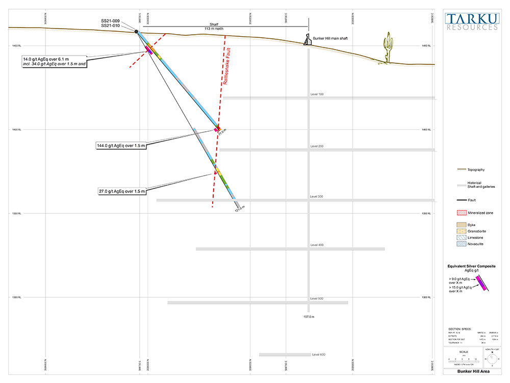
| SS21-009 | Bunker Hill | 10,7 | 16,8 | 6,1 | 13 | 0,03 | 0,01 | 14 | 0,04 | 0,12 | ||
| incl, | 13,7 | 15,2 | 1,5 | 24 | 0,08 | 0,11 | 0,05 | 34 | 0,16 | 0,25 | ||
| SS21-009 | Bunker Hill | 74,7 | 76,2 | 1,5 | 67 | 0,30 | 0,07 | 1,28 | 0,55 | 144 | 1,82 | 2,61 |
| SS21-010 | Bunker Hill | 96,0 | 97,5 | 1,5 | 11 | 0,07 | 0,29 | 0,14 | 27 | 0,42 | 0,85 | |
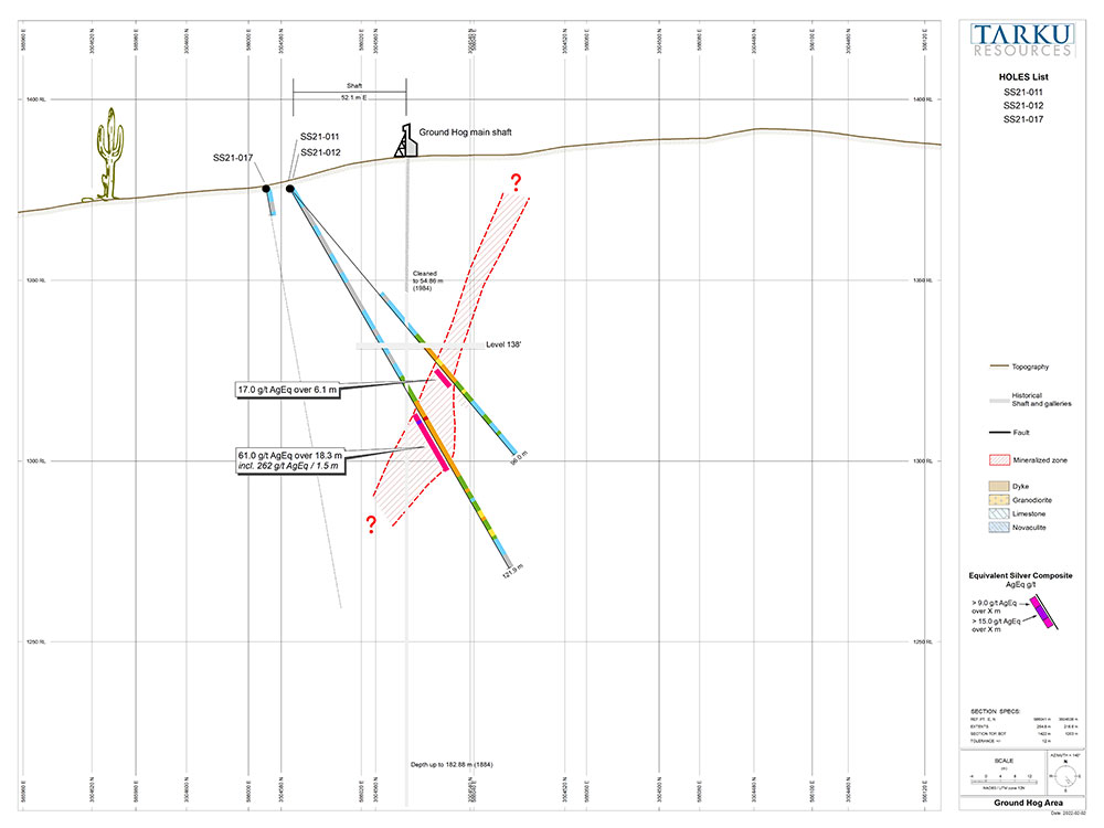
| SS21-011 | Ground Hog | 64,0 | 70,1 | 6,1 | 11 | 0,03 | 0,00 | 0,10 | 0,03 | 17 | 0,13 | 0,16 |
| SS21-012 | Ground Hog | 71,6 | 89,9 | 18,3 | 31 | 0,15 | 0,00 | 0,51 | 0,19 | 61 | 0,70 | 1,60 |
| incl. | 73,2 | 74,7 | 1,5 | 204 | 0,38 | 0,00 | 0,90 | 0,28 | 262 | 1,19 | 0,35 | |
| SS21-013 | Ground Hog | No significant results | ||||||||||
| SS21-014 | Ground Hog | No significant results | ||||||||||
| SS21-015 | Ground Hog | 134,1 | 141,7 | 7,6 | 13 | 0,32 | 0,00 | 0,13 | 0,26 | 48 | 0,38 | 2,08 |
| SS21-016 | Ground Hog | 76,2 | 77,7 | 1,5 | 26 | 0,47 | 0,00 | 0,59 | 0,36 | 86 | 0,94 | 5,13 |
| SS21-017 | Ground Hog | No significant results | ||||||||||
| SS21-018 | West Rattlesnake | Abandoned hole | ||||||||||
| SS21-019 | West Rattlesnake | No significant results | ||||||||||
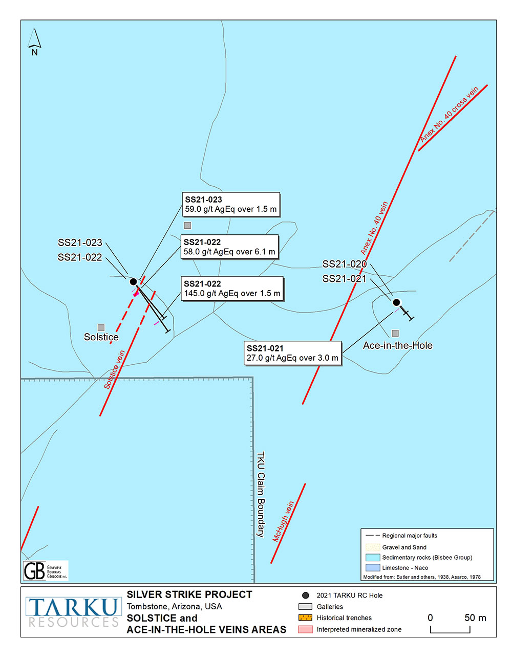
| SS21-020 | Ace in the Hole | 95,0 | 120,0 | 25,0 | 9 | 0,09 | 0,00 | 0,10 | 0,31 | 28 | 0,41 | 0,65 |
| SS21-021 | Ace in the Hole | 44,2 | 47,2 | 3,0 | 11 | 0,00 | 0,00 | 0,05 | 0,47 | 27 | 0,53 | 0,63 |
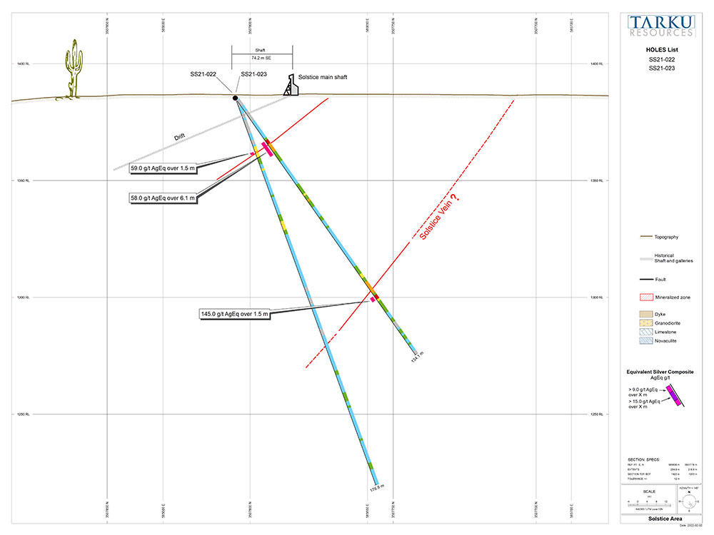
| SS21-022 | Solstice | 22,9 | 29,0 | 6,1 | 45 | 0,05 | 0,00 | 0,10 | 0,21 | 58 | 0,31 | 1,30 |
| SS21-022 | Solstice | 103,6 | 105,2 | 1,5 | 96 | 0,41 | 0,00 | 0,13 | 0,49 | 145 | 0,62 | 5,66 |
| SS21-023 | Solstice | 24,4 | 25,9 | 1,5 | 40 | 0,10 | 0,00 | 0,22 | 0,19 | 59 | 0,42 | 2,19 |
- Ag Equivalent (AgEq): Only samples with over 5g/t Ag and over 0.05g/t Au were used - Prices of $24/oz silver, $1,800/oz gold (ratio Au:Ag = 65:1), $4.00/lb copper (ratio Cu:Ag = 0.01:1), $0.90/lb lead (ratio Pb:Ag = 0.002:1) and $1.20/lb zinc (ratio Zn:Ag = 0.003:1) were used for equivalent calculations. 100% recoveries have been considered as no metallurgical study has been made yet.
- Intervals shown are drill intercept, true thickness cannot be calculated yet.
Exploration Pipelines
The next phase of exploration at Silver Strike
- Phase 2 will encompass Geophysical and Geochemical regional surveys to prepare for an expanded core drilling program on priority targets (Phase 3).
- Geophysical survey: TDEM (Time-Domain EM), measuring at least 2 types of physical phenomena : Electromagnetic (EM) induction, which will be used to map Conductivity, and Induced polarization (IP) that could provide data on chargeability. Potential mineralized target will appear.
- Geochemical and sampling survey : bedrock is outcropping regularly, and mineralization is known to be close from surface. Extensive and homogeneous soil and rock sampling will return a map showing alterations and mineralization halos.
- Phase 3 will include Core drilling on targets determined to be most promising within Phase 2.
- Phase 4 will be the preparation of a Technical report (compliant with National Instrument 43-101) and Silver Strike’s initial resource estimate.
